So I was thinking to myself that there aren't enough tramps available on the internet, so there will be summaries of my tramps on here from now on.
Roaring Meg Hut
Target: Roaring Meg Hut
Start: Roaring Meg Picnic area / lookout on Cromwell-Queenstown road.
Time (Doc): 6-7 hours each way
Time (Me): 4.5 hours in, 3.5 hours out.
GPX (approx): http://the.earth.li/~alex/tmp/roaring-meg.gpx
Basically, you start at the Roaring Meg lookout, where there is plenty of parking and you can probably sneak in an overnight stay if you're tidy, walk past the sign in the picnic area and through the forest for fifteen minutes. You pop out on the 4WD track to the Roaring Meg dam/hydro scheme and follow this up the side of the Roaring Meg for about an hour, climbing gradually. After a couple of switchbacks to gain height in a small block of forest, the 4WD track descends to the dam, but you stay high and follow a thin trail above the true left of the Roaring Meg.
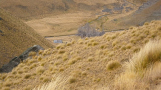
This trail is pretty easy to follow and has poles every couple of hundred meters. After another hour, you descend to the stream where you must cross the stream. I couldn't find anywhere to jump over the stream without getting my feet wet, and on the way out after some rain was wading to my knees. You now leave the stream and head a short distance along the side-gorge then turn right, climbing steeply for a little way to exit the gorge. A trail runs roughly parallel to the Roaring Meg, but a few hundred meters to its right, over rolling tussock covered hills. After about fourty minutes you descend slightly back to the Roaring Meg and a flat with a small musterers hut.
From here you have two choices. You can follow the poled route, which climbs an old farm track to the crest of the range, or you can leave the poled route and simply sidle along the gorge of the Roaring Meg.
If you chose to stick to the poled route, you ascend fairly steeply, following the course of a wee burn. At the crest of the ridge, you turn right and leave the roaring meg pack track (which continues down to Cardrona), and follow along the ridge for about a hundred meters before turning east and dropping down a track, reaching the flat with the roaring meg hut after about twenty minutes.
If you chose to follow the gorge, there is a faint track but you may sometimes find it easier to wade up the stream. The best route is usually about twenty meters above the level of the stream, on its right. After about fourty minutes you'll get to a flat and may need to cross the stream once or twice to avoid steep sides or miss out curves. The hut in on the left of the stream just above the old gold tailings.
The hut itself has 12 sleeping spaces, including a sort of double-bed type space. There is a fire and nearby poisoned pine trees for fuel. If you are lucky someone will have left you some dry wood, if not, you can get chopping.
I imagine this trip might have some hairy moments if there was a covering of snow between 800 and 1000 meters. From the hut you can go back to the Roaring Meg carpark, continue to Cardrona via Touhey's Gulley (the continuation of the Roaring Meg pack track) or follow a poled route away from the hut which goes over the tops to Lowburn.
Crossing the Roaring Meg
See also: http://www.smiths.net.nz/meg.html.
Subscribe to:
Post Comments (Atom)


No comments:
Post a Comment